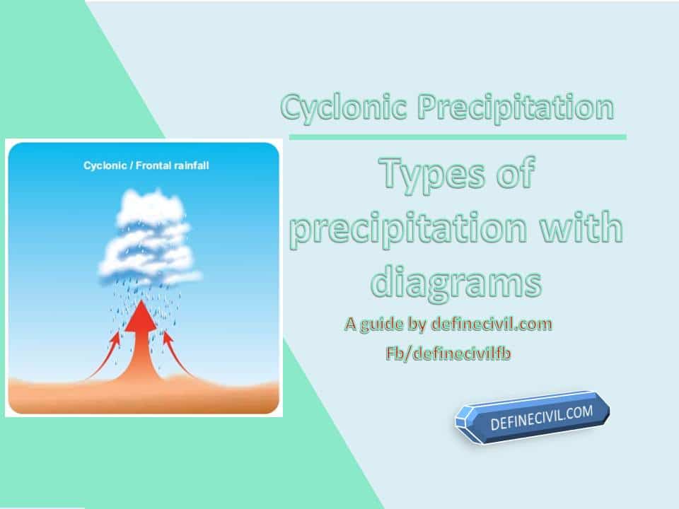
Cyclonic precipitation is a type of precipitation that results from lifting of air masses converging into low pressure area in the atmosphere. Cyclonic precipitation as the name suggests is a result of cyclonic activity. It’s a concept that is bit different from the conventional rainfall or conventional precipitation.
In conventional precipitation, the rainfall happens as a result of convection currents. This generally is a short duration precipitation that normally happens only in northern hemisphere or tropical regions. Cyclonic precipitation on the other hand can continue for several days and generally occurs in coastal areas of the world.
In today’s article we’re going to elaborate in-depth the concept of what is cyclonic precipitation, what are different types of cyclonic precipitation, what are some risks, and how one can protect from such destruction.
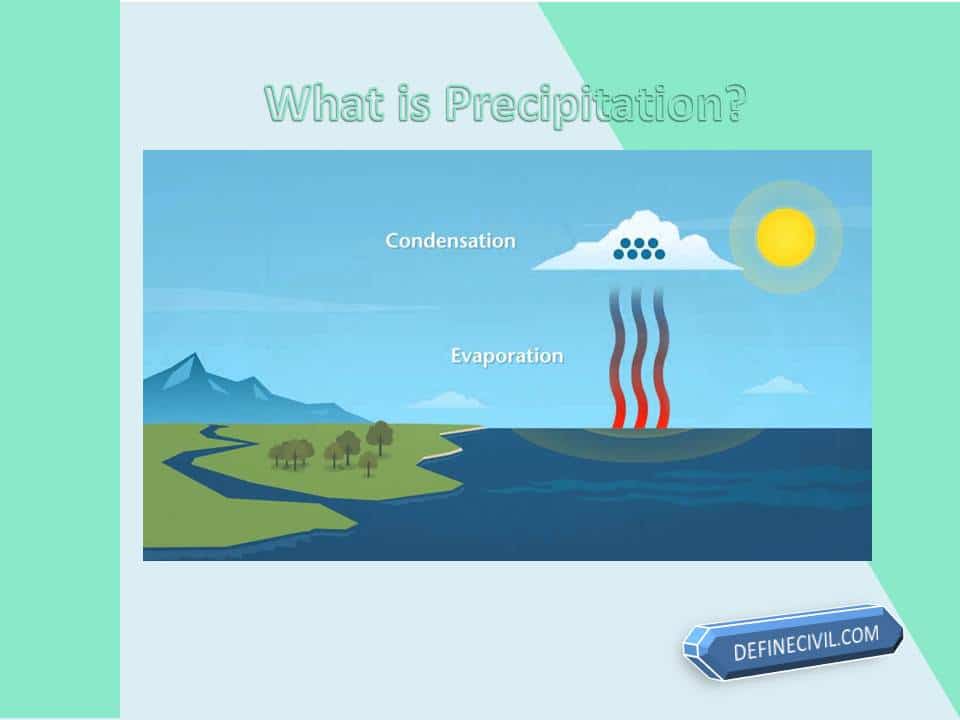
What is Precipitation?
Let’s now start with the basics of what is precipitation.
Well, precipitation is the natural process that causes water to fall from the sky onto the earth. Water vapor forms as a result of temperature difference got condensed result in the formation of clouds. These clouds bring rainfall or precipitation under the gravitation force in the form of liquid droplets, snow, dew, or frost.
Precipitation can come in many forms: sleet, hail, and even liquid droplets called fog are all types of precipitation. All sorts of precipitation involve moisture coming out of clouds into contact with our planet’s atmosphere.
Types of Precipitation:
Generally, there are three types of precipitation:
- Cyclonic
- Convective
- Orographic
Cyclonic precipitation
Cyclonic precipitation occurs when air masses spin and bring warm, moist tropical air from the earth’s surface up to higher altitudes. Cyclonic precipitation happens in two different ways:
either as convective rain showers or as snowstorms.
- Cyclone Rain Showers occur because of the collision between the cold, dry polar air and warm, humid subtropical air.
- Cyclones can also cause snowstorms by lifting warmer, moister atmospheric parcels into cooler regions where they freeze more quickly.
- We define cyclone as an area of low pressure in a Northern Hemisphere with circulation of air around it which is generally inward and towards the center. Most of the storms we see in the Great Plains states are due to cyclonic precipitation.
Orographic Precipitation
This is typically a relief precipitation that is because of forced upward movement of moist air by terrain or features like mountains, hills etc. We call these natural topographic features as barriers. They play a crucial part in lifting the air up to condense and cause precipitation.
- It results in rain, snow, or even other precipitation types. Normally very heavy precipitation occurs when upwind in a mountain range move across a prevailing wind from a warm ocean.
- Normally, the precipitation is more on the windward side of the features. That’s the side where striking occurs. While the other end gets a little amount of rain and we call it the rain shadow region. In India, Orographic rainfall is pretty common along Bay of Bengal, Mawsynram, and other parts of South India.
Convective Precipitation
The Convective precipitation is different from cyclonic or orographic precipitation. In Convective precipitation the air is lifted and move upwards as it is lighter than the colder and denser surroundings. For example on a hot day the ground becomes heated. Alongside the air also comes in contact and gets heated. Resultantly, the air rises, expands and cool dynamically, causing condensation and precipitation.
Types of cyclonic precipitation and what they do
The cyclonic precipitation may be divided into two-part
- Frontal Precipitation
- Non-Frontal Precipitation
Frontal Precipitation
When two air masses with contrasting densities and temperatures collide, they produce a front or frontal surface. These fronts can lead to precipitation if the temperature difference is significant enough. This type of precipitation is called frontal precipitation.
Non-Frontal Precipitation:
There is an epic battle for domination in non-frontal precipitation when a warm moist air mass becomes stationary and meets with colder moving air masses. This passive ascent happens because the lightness in weight from warm over hard causes it to be lifted by this active undercutting process.
Cyclonic Rainfall
Cyclonic rainfall, also known as frontal rain, is caused when two air masses of different temperatures meet, where one will rise over the other and create a front with clouds that produce heavy rains to follow shortly after.
How does Cyclonic Rainfall form?
Frontal or cyclonic rain is the most common form of rainfall, and it often occurs on a rainy day due to cyclonic activity. Fronts are formed when two masses of air with different temperatures, humidity, or density meet. These fronts can be warm (leading) or cold (trailing).
When this happens in an area where there’s moisture present – like clouds altostratus, which occurs during sunny days because they’re made up mostly of water vapour-the moist air cools as it rises into higher altitude levels before condensing into tiny droplets that create precipitation.
What are the risks of cyclonic precipitation?
Nature has always been in control of what’s happening on the planet, and it will be for all eternity. The destruction from a tropical cyclone is influenced by factors such as its intensity, size, and location when making landfall.
Cyclones can cause heavy rain to fall around their area of impact while also bringing with them strong wind gusts that are capable of knocking down trees or ripping off roofs if they’re not appropriately secured beforehand.
Storm surges near land may reach deep inland along with coastal areas due to high waves crashing ashore at once, which causes significant erosion that could lead to more flooding than residents might have experienced before during normal hurricane events within previous years without storm surge coming close enough; however, this would require an intense cyclone reaching low-lying shorelines.
How can you protect yourself from cyclonic precipitation?
Here’re some of the effective measures to protect yourself while facing a cyclonic precipitation or cyclone disaster:
- Disconnect Electricity, Gas, And Water
- Put Away Outdoor Furniture And Toys
- Keep An Emergency Kit On-Hand
- Tune In To Local Radio And Television News
- Evacuate Immediately If Ordered
- Stay In The Strongest Part Of The House
- Protect Yourself With Strong And Sturdy Furniture
- Beware The Eye Of The Storm
- Don’t Enter Floodwaters